


WhatsThat Location Detector

Descriere WhatsThat Location Detector
We all often travel to the most amazing places on earth with prominent landmarks and breathtaking landscapes. Sometimes at remote places like mountains, lakes, old towns and islands. Ofcourse, with a one in a blue moon trip like those, no one would wanna miss out on any famous landmarks and prominent places nearby. Travel in style with your personal navigator and location detector WhatsThat which tells you what you are looking at with just a snap from your camera.
Imagine you are admiring the beautiful mountain range on your trip, and never realizing that you are looking at prominent valleys, caves, peaks and lakes! WhatsThat Location Detector will tell you exactly what you are looking at from a range of 100 meters - 10 km (~110 yards - 6.2 miles).
The app is a great guide and useful especially for navigating in new places, traveling in mountains, for trips in the city, and outside in the nature. It also includes built-in automatic distance measure/meter for long ranges.
How To Use:
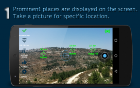
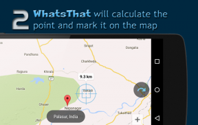
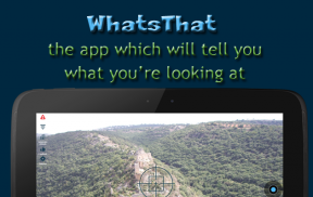
Hold your device horizontally. Within few seconds name and range of prominent places will be marked on the camera screen (Augmented Reality - AR). For any other location, point the sight/crosshair of the camera on the point you want information about, and take a photo (blue circle in the right of the screen). WhatsThat will detect the location and mark it on the map.
## Breathtaking Features ##
★ Built with Augmented reality (AR) Engine - prominent places are marked on the camera screen automatically
★ Location detector & Rangefinder/Milo-meter (distance indicated with a point on your map)
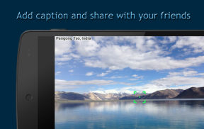
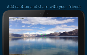
★ Share the location photo, including name of the place, with your friends
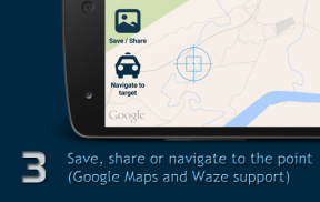
★ Navigate Locations to the point on the map (Google Maps/Waze support)
★ Embedded with high quality Google Maps API
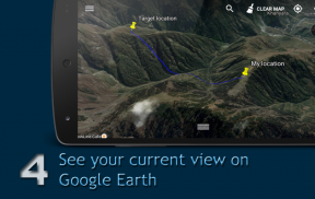
★ Google Earth integration: opens Google Earth app with the view of your location & target location and saves a file for opening in your PC or other device.
How does it work?
Augmented reality: WhatsThat detects prominent places around you. Based on your location & your device angle, our algorithm marks them on the camera screen, so you see the places on your screen and a marker above them with the names of the places and its ranges.
Location detection: When you take a photo, WhatsThat draws an imaginary parallel line from your camera lens to the ground. The app works under any lighting or other condition because it is based on the angle of your device, your location and the area’s topography. You will get the same result in pitch black conditions or behind a wall.
Getting the best result:
• Ensure that your device’s reception is optimal: note the symbol in the top left corner of your camera display. It will go from green to yellow to red as reception weakens.
• Press the symbol for instructions on how to improve your reception.
• Make sure your compass is accurate. Keep the device away from metals and other things which may disrupt the compass
• Aim at a point on the ground. For example, if you are looking at a building, aim at the point at which the building meets the ground.
• Activate all location services: GPS satellites and wireless networks.
• Within a building or when GPS is not active specify your altitude (building icon on the left)
Accuracy:
WhatsThat’s accuracy is influenced by the accuracy of your GPS & other location services, your compass & movement sensor, and topographical databases. The average margin of error is 10%, given optimal device conditions - when GPS is working and your device compass is accurate. That is, if the object is 1 km away, there may an error of up to 100 mtrs. We are always striving to improve our accuracy.
Permission & Their Usage:
Access to camera & location services.
Media Files: To save photos that you take with the camera.
Network: To load the map, terrain data, etc.
WhatsThat sends anonymized statistical information for improvements.
Stay in touch! Email questions, suggestions and ideas to: sabressoft@gmail.com


